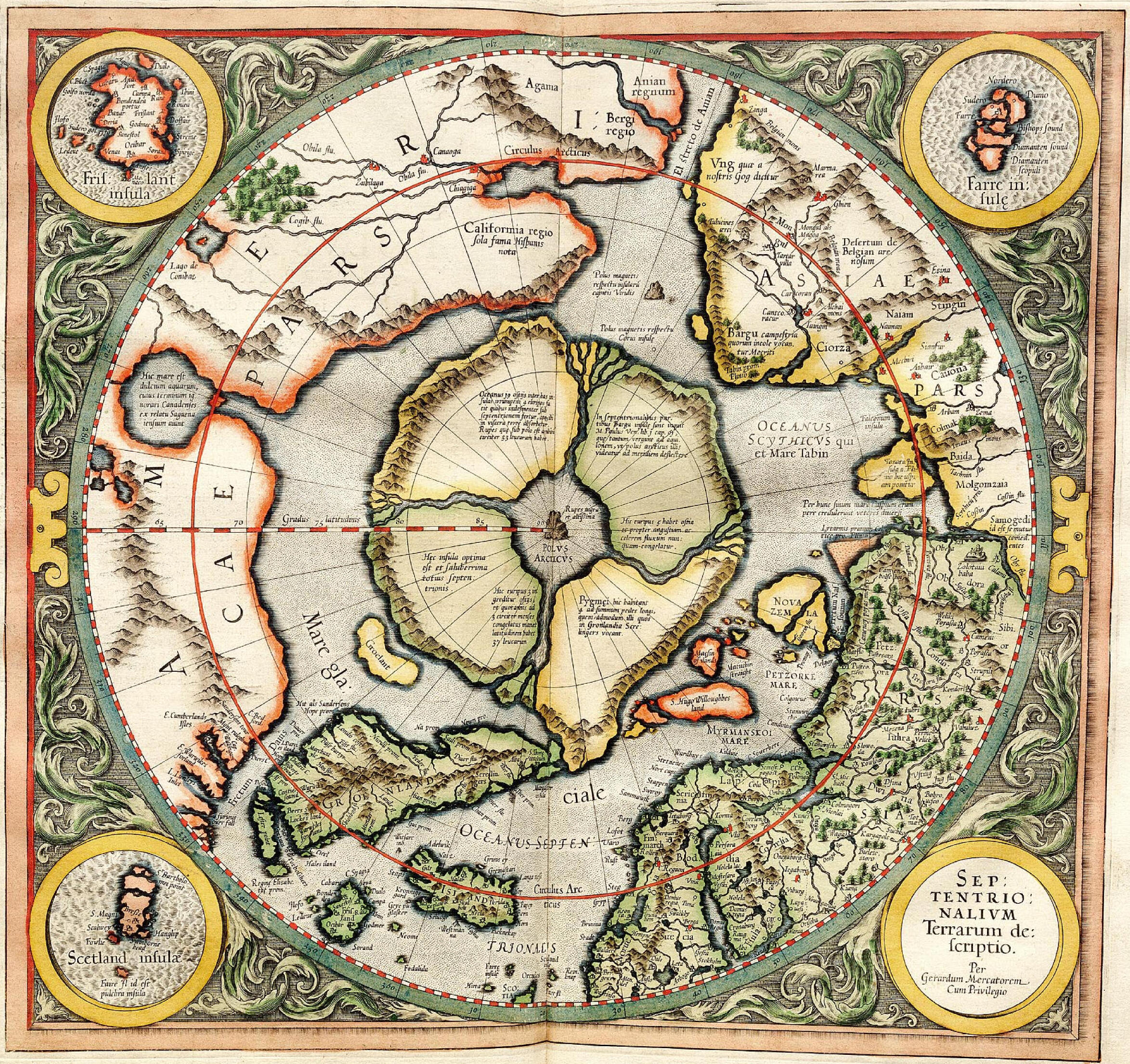
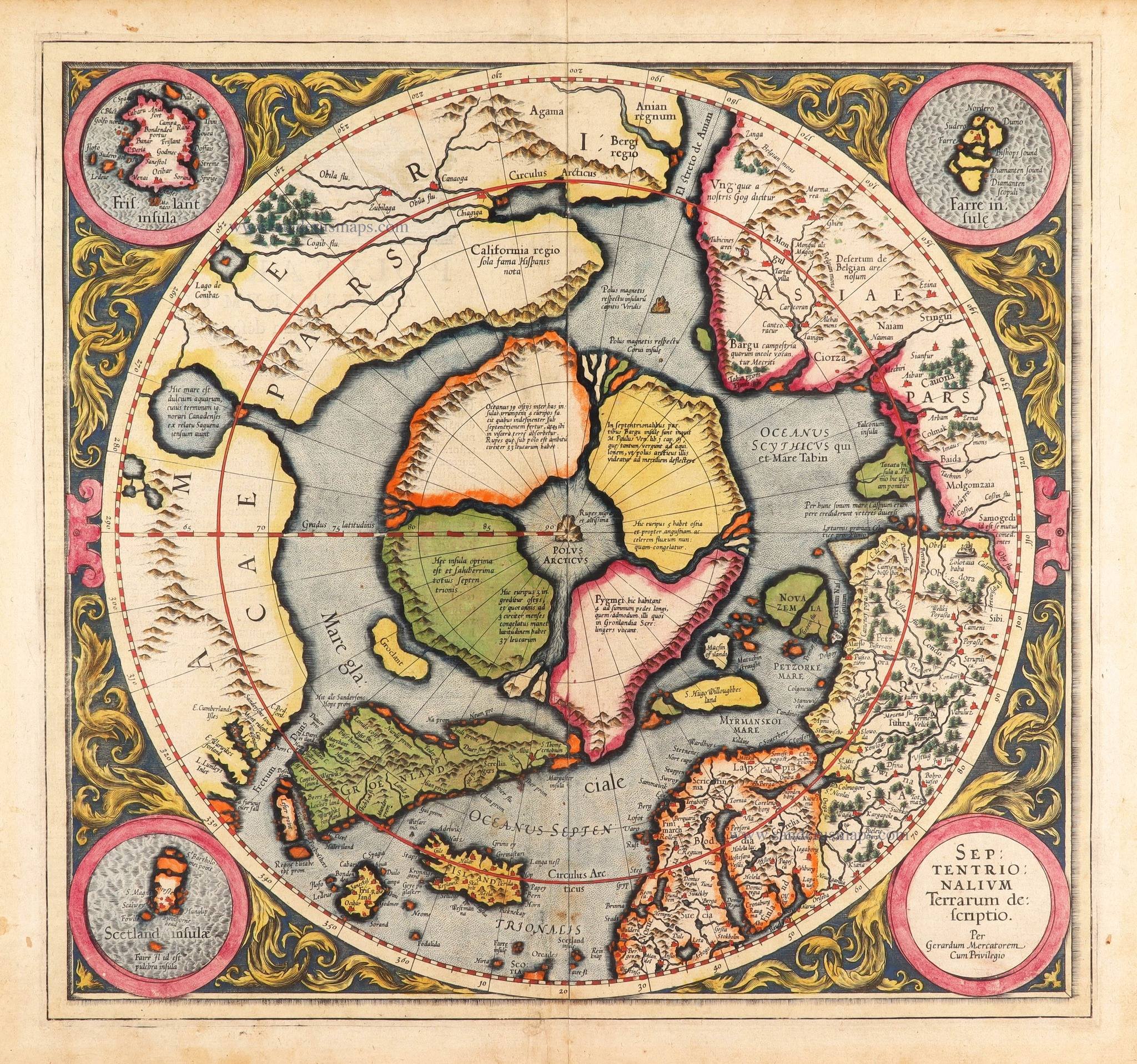
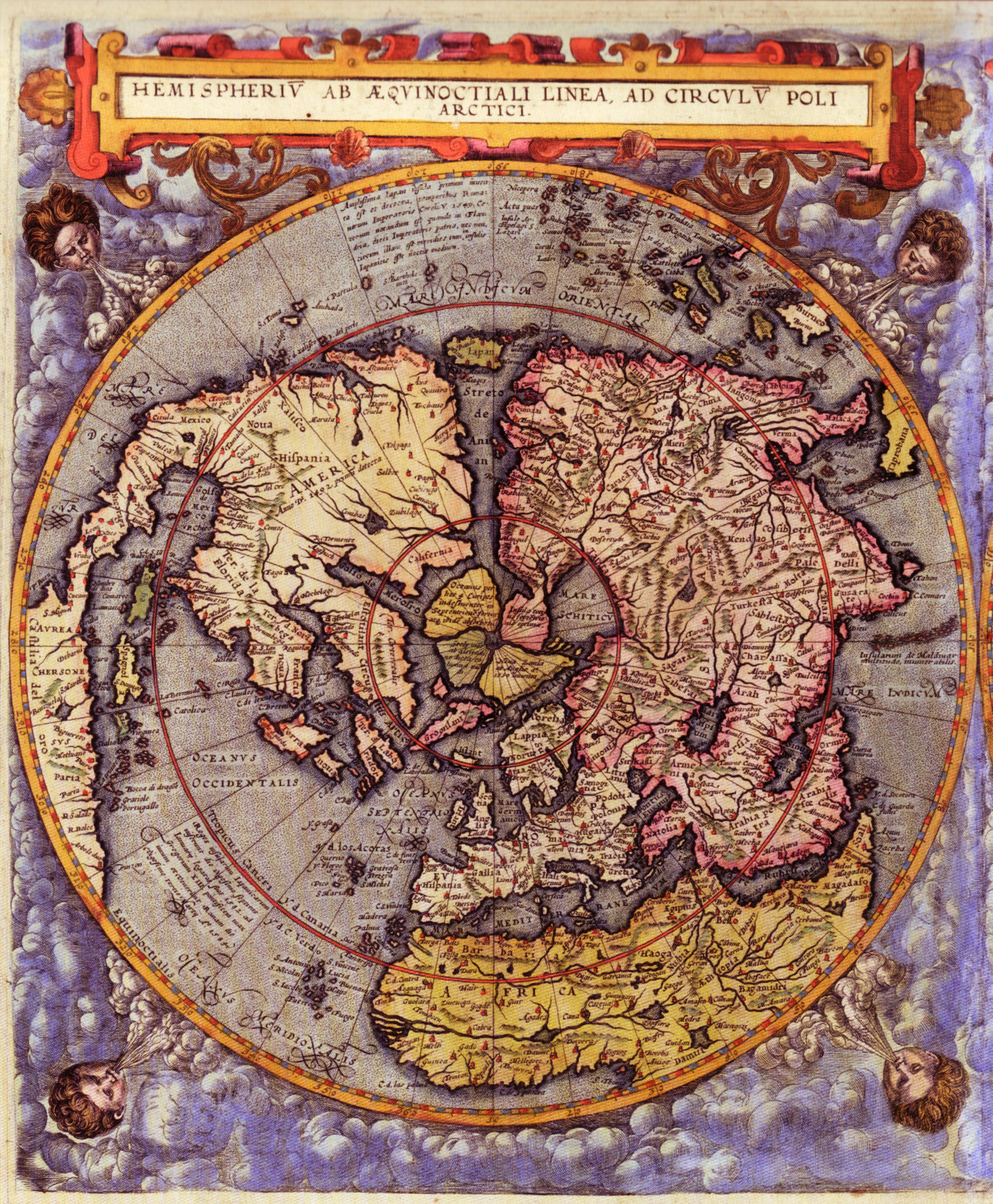
Latina: Hemisperium ab aequinoctiali linea, ad circulum poli arctici. Antwerp 1593English: Map of the Northern hemispere, Antwerp 1593. Color print from copper engraving (printer Arnold Coninx), 33 x 52 cmDate 1593Source Society of Jesus in Prague New TownAuthor Gerard de JodeOther versions File:Gerard de Jode 1593 Map Southern hemisphere.jpg, (the Southern hemispere part)The map is an early example of the imaginatory powers of cartographers. Gerard de Jode has visualized the appearance of the Earth as if seen from orbit at a vantage point above the northern celestial pole. Gerard de Jode´s map was published in an atlas by Cornelis de Jode Speculum Orbis Terrae of which the library of the Society of Jesus in Prague New Town has a copy. This is a scanned image from a calendar, the Czech Repulic and the World, 2009. Factual information is sourced from calendar commentary written by Prof. Eva Semotanová
Atlas Cosmographicae 01/01/1596, atualizado em 17/01/2026 22:12:58 Créditos/fonte: